I’m trying out something new here — limiting myself to 5 photos from my collection, and telling the story around those images.
Immediately after finishing my junior year of college I took a trip. This was late April 1992.
No parents. No friends. No cell phone. No GPS.
I flew from Ohio to San Francisco, dragging along a big duffle bag of backpacking gear—backpack, tent, stove, water bottles, sleeping bag, etc. I was headed to a weeklong Sierra Club “outings” trip in northern California, among the redwoods and out on what’s known as the Lost Coast. I’d never been there before and I didn’t know anyone on the trip.
Upon arrival in San Francisco I made my way out to the Napa Valley on a local shuttle. I was met by a German immigrant woman. She was organizing the trip. I hitched a ride with her north, up into Humboldt County where the trees are mind-bogglingly huge.
Rockin’ and Rollin’
Before I landed in San Francisco there’d been a large earthquake in northern California. The 7.2 temblor had been felt in San Francisco, but the epicenter was 200+ miles away, so the locals didn’t seem too concerned.
Except it was centered right where we were headed. I was assured this shouldn’t be a problem. So we drove north.

We stopped in Myers Flat for the first night, staying in a rickety old motel until everyone was able to gather the next morning and formally start the trip with breakfast at a local diner.
But here’s the thing about big earthquakes: they have aftershocks. For days. Even weeks.
Overnight, in the motel, there were 2 major earthquakes—the first I had ever experienced:
- M 6.5 – 30 km WSW of Ferndale, California
1992-04-26 07:41:40 (UTC)
40.433°N 124.566°W - M 6.6 – 32 km SW of Ferndale, California
1992-04-26 11:18:25 (UTC)
40.383°N 124.555°W
I was about 30 miles from the epicenter of these quakes. And I felt it. Buddy… there was no way to miss it.
The first started off as a rolling kind of shake. You could feel the waves. I was in bed in my motel room at 12:41 a.m. when the walls started to gently creak. For a moment I literally thought there was some amorous motel encounter going on next door. Despite knowing about the prior day’s earthquake it didn’t even occur to me this was another one. Plus… what did I know?
Once I grokked the situation, I bolted upright and made for the nearest doorway (which I’d seen in safety movies). When the rolling shake was over, with no noticeable damage, I popped my head out the motel door and checked in with my neighbor, a long-time California resident familiar with earthquakes.
I was beaming. I’d always wanted to experience an earthquake, so this trip was off to a great start. Not having any sense of earthquake sizes, all I knew was (a) I wasn’t injured, and (b) the building was still standing. Heck, even the 20-inch tube TV mounted on a cheap metal tube arm high up on the wall with the faux wood paneling was still in place.
Grinning from ear to ear, I asked my more-experienced neighbor, “Was that a big one?!?” They were… less enthused. Through an ashen face of fear they replied, “Yeah. That was a big one.” I thought it was fun, but they were worried.
The shaking was done, it was late, I was tired, so I went back to bed as the excitement wore off. After all, there was no mobile Internet or social media in 1992, so geeking out on the quake or making wisecracks about it wasn’t an option. Plus I had a big trip starting in the morning.
Less than 4 hours later, long before sunrise, another earthquake. This one didn’t roll. It violently shook the bed and walls. It felt angry. I was less delighted this time. After the shake the neighbors and I looked at each other in the darkness, waved, wearily, and without a word we all went back to bed, exhausted.
Pitch your tent in a Red Cross emergency camp
The drive out to the Lost Coast takes a winding road through the northern California mountains. It’s the kind of drive you either love or hate. But it’s the only way to reach the mouth of Mattole River and the northern end of the famously undeveloped coastline.
On the drive to the coast from Myers Flat we got stopped at Petrolia because the earthquakes had brought down landslides over the road. Crews were working to clear the slides, but it would take another day or so. We would have to wait in the little town of Petrolia. But we couldn’t even drive into Petrolia itself—we had to walk across a 50-foot-high concrete bridge over the river that hadn’t been cleared by structural engineers as safe for vehicles yet. So we hiked across the bridge, a little nervously, and into town.
Petrolia was just 3 miles away from the 7.2 earthquake on April 25. The quake broke and ignited gas lines in the tiny metropolis, burning the general store / post office to the ground.

Since we were on a backpacking trip, we already had all our food for the days ahead, and we had tents and sleeping bags — we were ready for anything. With the road to the coast closed, there was nothing to do but join some of the locals and relief workers in a makeshift Red Cross emergency camp in town. We pitched our fancy lightweight backpacking tents amongst the heavy emergency tents and waited. With water readily available and portable toilets, it was the fanciest backpacking destination I’d ever seen.
We chatted with locals. Toured the damage. We greeted a helicopter that landed in the local school’s football field. It was a news crew out of San Francisco that wanted the local story and some video. I suspect our tents were shot on some b-roll footage, but we had no way to see the story.
The next day we were given the green light to head out. The road to the coast had literally been cleared. We walked back across the questionable bridge, hopped in our cars and headed west to the Pacific, just a few miles away.
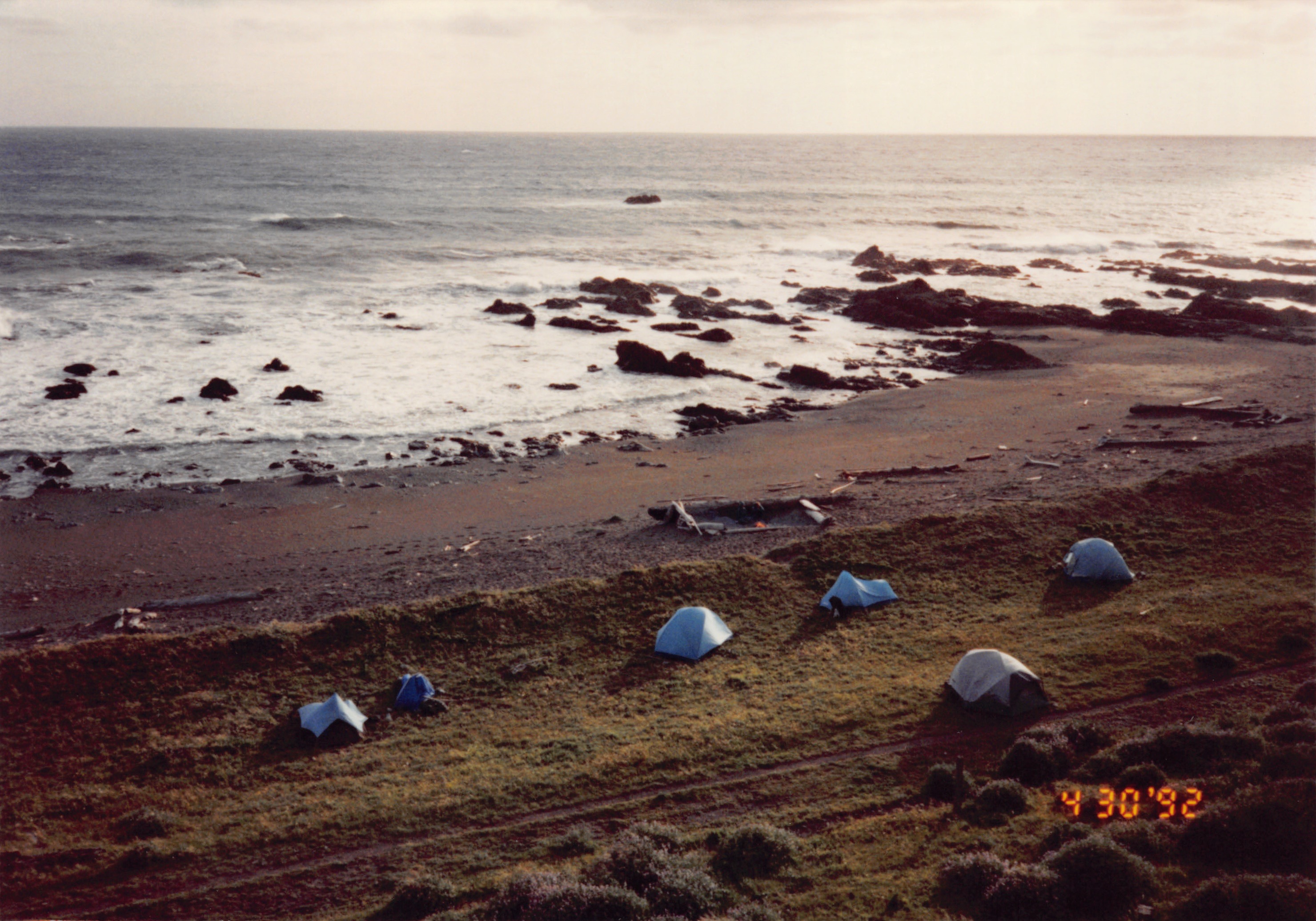
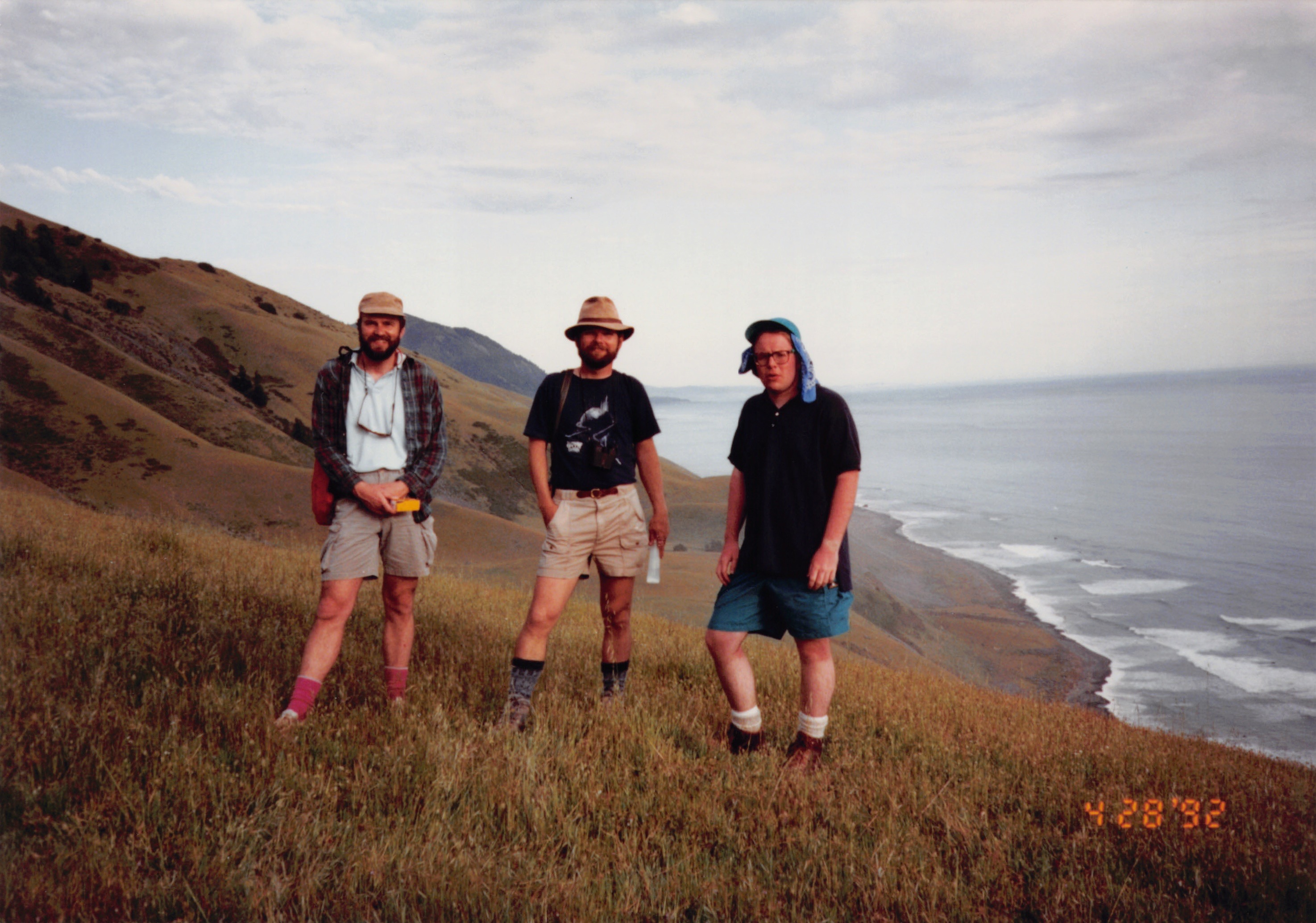
Hiking the Lost Coast

Our group parked the cars at the end of the road and walked out onto the beach. It’s a remarkable place, so far from highways and all other kinds of infrastructure. It’s harsh and beautiful all at once.
After the first night on the Lost Coast one of the Californians asked if I’d felt the earthquake overnight. I had no idea there was an earthquake—didn’t feel a thing. So I replied with a deadpan, “I don’t wake up for anything less than a 6-point-oh.” They thought that was hilarious, coming from a Midwest boy.

We hiked south along the coast. I learned just how hard it is to walk on sand with a fully-loaded backpack. I learned that a cool ocean breeze can lull you into a false sense of sunburn security. I learned a bit about the Chumash people that used to roam this landscape.
This was also the first place I’d backpacked where you needed a tide table to navigate. Some parts of the trail are impassable when the tide is in. I had topographic maps, but with the Pacific on one side and the Kings Range mountains on the other, you didn’t really need much more information. To this day, I’m not sure how far south we made it before turning around and heading back to Mattole Beach to reach our cars.
Into the woods…
After the Lost Coast portion of the trip, we headed inland to hike around in the mountains and especially amongst the giant redwoods. I finally got to see what Endor is like in person. (No Ewoks.) Plus, I saw the infamous banana slugs everywhere (which, prior to this visit, sounded more like a myth to me).
…and then the riots
Remember the name Rodney King? Well, those riots started on April 29, while we were out on the Lost Coast, with no cell phones, no newspapers, no nothing. We left the world on a seismic wave and came back to social upheaval that meant a lot to several people in our group, some of whom lived in Los Angeles and were freaked out by the newspaper headlines we saw at the National Park visitor center.
With the way the trip started and the murky haze of social unrest at the end, it was… a lot.
As the trip wrapped up I caught a ride back to SFO with one of my new hiking buddies and caught my red eye flight back to Ohio with just a couple hours to spare.
Analog audacity
To this day I marvel at the audacity of this young man—with no smartphone—jetting off by himself to California to meet up with strangers and walk around on the beach, miles and miles from a phone or a restaurant or a hospital or anything else modern. I’m not even sure I would do this today.
But if you can promise me a 6.5 quake in a creaky old motel and an ocean breeze for a few days, hit me up.
Discover more from digitalpolity.com
Subscribe to get the latest posts sent to your email.
