If February 2004 my wife and I escaped the Alaskan winter to find a little time in the southern California sun. I’d been working for an Alaska Native Corporation on a military contract at Fort Irwin, staying in Barstow, so I’d been getting to know the Mojave a little better, but I never had enough time to explore very far.
So we made a trip of it. She flew south to meet me at the Ontario airport in SoCal and we headed out to Death Valley National Park for a few days.
Temperatures during our trip were pretty mild, with highs in the upper 60s and mid-70s depending on where you were in the Park. That’s a far cry from the 125° F high point recorded in August of that year.
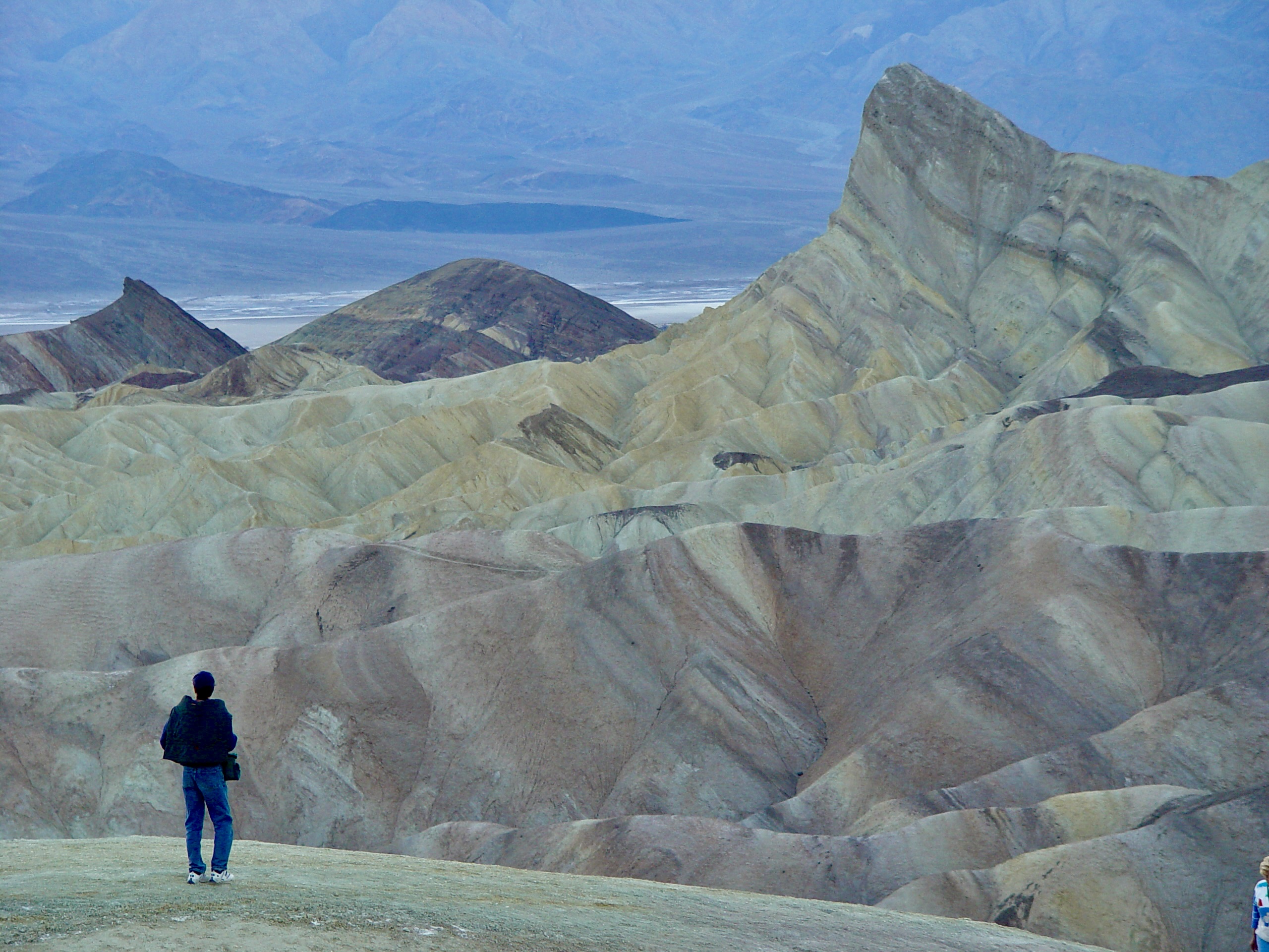
Ah, the views! Most days are pretty clear in Death Valley because, well… it’s the desert. Plus, there are plenty of places to get up high and look around. The Valley is a product of massively uplifted mountain ranges on either side, so you can drive to the top of one mountain ridge and look down, then drive into the valley and back up the other ridge for more views. It’s pretty spectacular. This view is looking northwest from the eastern edge of the Park, from an area called Dantes Ridge.The rock formations in Death Valley are really diverse, including volcanic cones, the massive mountain ranges on the east and west sides, and even a “natural bridge” area with large rock walls surrounding a canyon leading up the eastern mountainside. For an area that sees so little rain, the scale of the canyons is imposing. In this shot my wife is heading back down the canyon after our hike and scramble up the hill.The infamous Badwater Basin is the lowest point in North America and is essentially the middle of a giant salt flat. While it doesn’t rain much in Death Valley, it does actually rain sometimes, and the water leeches minerals out of the surrounding mountains and deposits them here as the water evaporates from the heat. Even if there’s surface water around, it’s “bad” for you in every way possible.Near Badwater Basin is the Devils Golf Course, a part of the salt flats where the minerals left behind form large, dangerously craggy crystalline rocks—the joke being if you tried to golf here, it would be hell. With an Earth Science degree, I find this stuff fascinating, so I took some time out to get a closer look. Thankfully, I didn’t leave any blood behind on the jagged rocks.Finally, this is the famous Zabriskie Point on the eastern edge of the Park, with colored rock formations reminiscent of the Badlands in South Dakota. The “point” in the photo even suggests the crest of a rock wave passing through the hills. We visited close to sunset, which gives the whole area a muted, hazy tone.
Discover more from digitalpolity.com
Subscribe to get the latest posts sent to your email.