5 photos: Earthquakes and The Lost Coast in 1992
I’m trying out something new here — limiting myself to 5 photos from my collection, and telling the story around those images.

Immediately after finishing my junior year of college I took a trip. This was late April 1992.

No parents. No friends. No cell phone. No GPS.

I flew from Ohio to San Francisco, dragging along a big duffle bag of backpacking gear—backpack, tent, stove, water bottles, sleeping bag, etc. I was headed to a weeklong Sierra Club “outings” trip in northern California, among the redwoods and out on what’s known as the Lost Coast. I’d never been there before and I didn’t know anyone on the trip.

Upon arrival in San Francisco I made my way out to the Napa Valley on a local shuttle. I was met by a German immigrant woman. She was organizing the trip. I hitched a ride with her north, up into Humboldt County where the trees are mind-bogglingly huge.

Rockin’ and Rollin’

Before I landed in San Francisco there’d been a large earthquake in northern California. It had been felt in San Francisco, but the epicenter was 200+ miles away, so the locals didn’t seen too concerned.

Except it was centered right where we were headed. I was assured this shouldn’t be a problem. So we drove north.

The “big one” on this map was a 7.2 quake hitting just 3 miles from Petrolia, a stop on our way to the Lost Coast. Special thanks to the awesome public servants at the USGS for maintaining a searchable earthquake database going back decades.

We stopped in Myers Flat for the first night, staying in a rickety old motel until everyone was able to gather the next morning and formally start the trip with breakfast at a local diner.

But here’s the thing about big earthquakes: they have aftershocks. For days.

Overnight, in the motel, there were 2 major earthquakes—the first I had ever experienced:

I was about 30 miles from the epicenter of these quakes. And I felt it. Buddy, there was no way to miss it.

The first started off as a rolling kind of shake. You could feel the waves. I was in my motel room, but bolted upright out of bed and made for the nearest reinforced doorway (which I’d seen in safety movies). When it was over, with no noticeable damage, I popped my head out the door and checked in with my motel neighbor, a long-time California resident familiar with earthquakes.

I was beaming—I’d always wanted to experience an earthquake, so this trip was off to a great start! Not having any sense of earthquake sizes, I asked my more-experienced compatriot, smiling from ear-to-ear: “Was that a big one?!?” They were… less enthused. Through an ashen face of fear they replied, “Yeah. That was a big one.” I thought it was fun, but they were worried. Way to harsh my buzz, pal.

The shaking was done, it was late, I was tired, so I went back to bed as the excitement wore off. Four hours later in the wee hours of the morning, another earthquake. This one didn’t roll. It violently shook the bed and walls. It felt angry. I was less delighted this time. I was only able to get a bit more sleep because I knew these were aftershocks rather than foreshocks. (That Earth Science training was paying off.)

Pitch your tent in a Red Cross emergency camp

The drive out to the Lost Coast takes a winding road through the northern California mountains. It’s the kind of drive you either love or hate. But it’s the only way to reach the mouth of Mattole River and the northern end of the famously undeveloped coastline.

We got stopped on the way to the coast at Petrolia because the earthquakes had brought down landslides over the road. Crews were working to clear the slides, but it would take another day or so. And we couldn’t even drive all the way into Petrolia itself—we had to walk across a bridge over the river that hadn’t been cleared by structural engineers as safe for vehicles yet. So we hiked across the bridge, a little nervously, and into town.

Petrolia was just 3 miles away from the 7.2 earthquake on April 25. The quake broke and ignited gas lines in the tiny metropolis, burning the general store / post office to the ground.

As strong and as close as the 7.2 quake was, this was, surprisingly, the worst of the damage.

Since we were on a backpacking trip, we already had all our food for the days ahead, and we had tents and sleeping bags — we were ready for anything. With the road to the coast closed, there was nothing to do but join some of the locals and relief workers in a makeshift Red Cross emergency camp in town. We pitched our fancy lightweight backpacking tents amongst the heavy emergency tents and waited. With water readily available and portable toilets, it was the fanciest backpacking destination I’d ever seen.

The next day we were given the green light to head out. The road to the coast had literally been cleared. We walked back across the questionable bridge, hopped in our cars and headed west to the Pacific, just a few miles away.

Hiking the Lost Coast

One hell of a talus pile. We don’t know if this was the result of the recent earthquakes or had been here for years.

Our group parked the cars at the end of the road and walked out onto the beach. It’s a remarkable place, so far from highways and all other kinds of infrastructure. It’s harsh and beautiful all at once.

Now THAT is how you tent camp.

After the first night on the Lost Coast one of the Californians asked if I’d felt the earthquake overnight. I had no idea there was an earthquake—didn’t feel a thing. So I replied, “I don’t wake up for anything less than a 6-point-oh.” They thought that was hilarious, coming from a Midwest boy.

Our group had all kinds of ages. We had a teenager younger than me, taking the trip with his mom. We had some folks in their 60s or perhaps older. It was quite the mix.

We hiked south along the coast. I learned just how hard it is to walk on sand with a fully-loaded backpack. I learned that a cool ocean breeze can lull you into a false sense of sunburn security. I learned a bit about the Chumash people that used to roam this landscape.

This was also the first place I’d backpacked where you needed a tide table to navigate. Some parts of the trail are impassable when the tide is in. I had topographic maps, but with the Pacific on one side and the Kings Range mountains on the other, you didn’t really need much more information. To this day, I’m not sure how far south we made it before turning around and heading back to Mattole Beach to reach our cars.

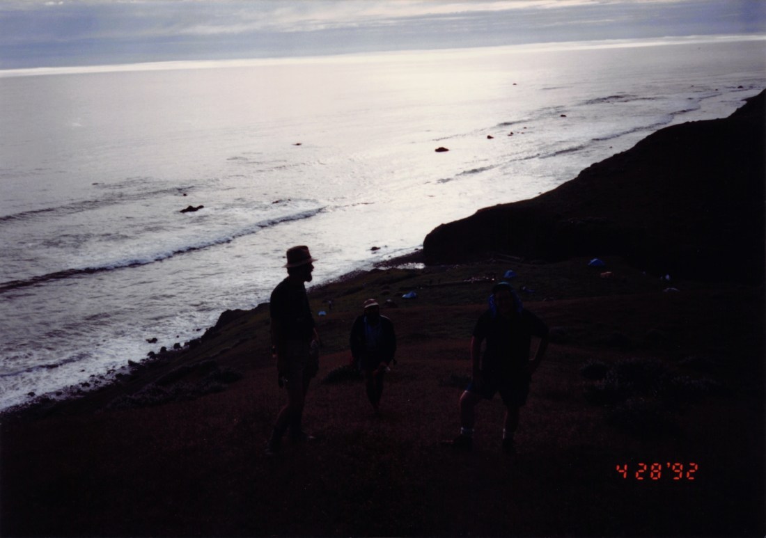
I’m on the right side of the photo, trying to not fall down the mountain, and suffering from a windswept sunburn. I literally cannot remember the names of these guys, though one of them drove me all the way back to SFO from northern California, telling me stories of working on software for VISA, the credit card company.

After the Lost Coast portion of the trip, we headed inland to hike around in the mountains and especially amongst the giant redwoods. I finally got to see what Endor is like in person. (No Ewoks.) Plus, I saw the infamous banana slugs everywhere (which, prior to this visit, sounded more like a myth to me).

To this day I marvel at the audacity of this young man—with no smartphone—jetting off by himself to California to meet up with strangers and walk around on the beach, miles and miles from a phone or a restaurant or a hospital or anything else modern. I’m not even sure I would do this today.

But if you can promise me a 6.5 quake and an ocean breeze for a few days, hit me up.

2013: Alaska to Ohio

I’ve driven between the midwest and Alaska a total of 6 times:

And I’ve got some photos from these epic 4,000-mile journeys. This post is the fifth and final post in the series.

July 2013: Anchorage, Alaska to Toledo, Ohio

By 2013 I had accomplished about everything I wanted to accomplish, career-wise, in Anchorage. While there were (and are) viable jobs on the Last Frontier, there wasn’t really a career path available. Plus, as my parents were entering their later years, I wanted to be closer to home. We’d lived though the passing of both my wife’s parents—we were in Alaska, and they were in upstate New York—and that long-distance experience was tough on everyone. Add to that a grim economic forecast for Alaska as the oil dried up, a major new natural gas pipeline proposal kept receding into the distance, and the corrupt politicians in Juneau failed to develop the State’s future… it was time to go.

While we had discussed living in the desert southwest, as a contrast to Alaska, and explored Bend, Oregon, too, we knew we needed to be closer to family in Ohio, not just anywhere in the Lower 48. And in Ohio, the only destination we considered was Columbus.

Scouting the move

To prepare, and possibly to find a job, I flew down to Columbus in June 2013. I met with potential employers and re-acquainted myself with a city I hadn’t lived in for 17 years. I would discover a lot had changed. The June trip included two events that cemented the feeling that Columbus would be a great destination, because it was dynamic and growing and full of new experiences.

While this wasn’t part of the drive down, it was part of the preparation: attending a Columbus Crew game. I had never attended a Major League Soccer game (or any soccer game) in my life, so this was a revelation. These days we watch the Crew on the MLS streaming service on Apple TV+ every week.
While re-exploring Columbus in June 2013 I also took in a Columbus Clippers game in the new Huntington Park stadium, a classic open-air stadium design that we love visiting to this day. Indeed, I was there earlier this week. PRO TIP: Avoid Dime-a-Dog night because the food lines are unbearably long and slow.
In the nearly 2 decades away, downtown Columbus created the Scioto Mile, moved COSI, and built new buildings around a revamped urban core. It had semi-trendy food spots, too (a trend that has grown over the past 10 years).

Getting a job meant quitting a job

Despite meeting with a few potential employers that were generally interested in hiring me, no one would offer me a job. Nobody believed someone would accept an offer, turn around, and move 4,000+ miles from Alaska. Or even if they did, it wouldn’t be quick. Plus, with local candidates readily available, why take the risk on the unknown?

Once I figured this out, the plan was clear: I would have to quit my job in Alaska, move south on my own (a second time), find a job, get an apartment to get settled, and then arrange for my wife to follow.

So that’s what I did. It was a little nerve-wracking. But the financial crisis of 2008 was largely over and jobs in white-collar Columbus were on the mend. It was as good a time as any time make the attempt.

I gave a month’s notice and Anchorage, wrapped things up, and made plans to leave at the end of July 2013.

Leaving the Last Frontier for the Last Time

On July 27, 2013 I headed out of Anchorage in a moderately-packed tiny car, planning to take at least a week on the road, winding my way down through Canada into Montana, through Yellowstone into Wyoming, then east to South Dakota and on to Minnesota and points southeast from there.

I would have loved to have some company.

But the solitary open road has been a “Camino” of mine several times, delineating the end of one life and the start of another. Days and days of 12, 14, and even 16 hours of driving alone can be a revelation. Especially when more than half of it winds through the rockies and the high plains.

Yep—I drove my Scion iQ from Alaska to Ohio. This tiny city car made the trip, no problem. And I kept driving it in Ohio for a couple more years after this. Here I’m parked in front of our final apartment in Alaska, with the car packed up and ready to go. This was actually a sad day for several reasons. I was leaving Alaska for the last time, leaving behind my wife, and leaving behind our beloved dog Angus, a Cairn Terrier we brought with us to Alaska in 2001, and who was only a couple weeks away from the end of his life. My wife would join me in Ohio about 2.5 months later.
The Chugach Mountains northeast of Anchorage gave me a proper Alaskan send-off, with fireweed in full bloom. Southcentral Alaskan summers were always short, intense, and often lovely like this.
One final view of the Matanuska Glacier, on the north side of the Chugach Mountains.
It’s been 11 years this summer since I crossed the border out there on the frontier. Perhaps one day I’ll see this unique international crossing on the Alaska Highway again.
A rainbow crossed my path driving out of Destruction Bay, on the south end of Kluane Lake, headed to Haines Junction and on to Whitehorse, Yukon Territory.
Crossing through the Canadian Rockies in northern BC is a treat any time of year. Luckily I had beautiful weather for this summer drive.
Back in the United States I drove south into Montana, headed toward Yellowstone, just to drive through and see the gigantic caldera for myself, for the first time. Sadly, I didn’t take a lot of photos or even spend that much time in the National Park. With the crush of tourists and the traffic, I didn’t feel like hanging out.
I was greeted by a bison of the stuffed variety in my hotel room in Cody, Wyoming. Cute! But $22 even in 2013? No, thanks.
Driving east out of Cody I got to experience some classic western landscapes I’d never seen before. There are places there that seem unknown. Despite it being early August there just wasn’t evidence of tourism. I wonder if it’s still as pristine today.
A tiny car in a big landscape.
On my extended trip back to Ohio I stopped off to see the Crazy Horse Memorial in South Dakota. This was my first visit to this Native American answer to Mount Rushmore. I just wish it was funded well enough to be completed.
I had also never visited the Badlands in South Dakota, but this time I made the side trip. A stunning landscape to be sure.
Alaska plates in the Lower 48 will often get second looks. But Alaska plates on an unusually tiny car gets all the second looks at a rest area in southeastern Wisconsin.
Once back in Ohio, I was greeted—perhaps not so welcomingly—by Noah, my parents’ cat.

Back in Ohio

Once back in Ohio, in Toledo, I took a brief break and then started the job search again, heading down to Columbus to stay in hotels and even in a former colleague’s home as a house sitter and cat sitter. It only took a couple weeks to land a contract-to-hire role and a couple more weeks to nail down an apartment. By September was was moved into an apartment. In October my wife was ready to head south herself, with our Alaskan cat Ophelia in tow.

We’ve been in the Columbus area ever since, buying a home less than a year after arriving and settling in.

Would you move back?

Alaska is a truly unique place. It is a land of extremes in every sense. Anchorage was a city where everyone made new friends all the time because it’s a town of transients. And we made a lot of friends in 12.5 years.

Columbus and Ohio are… not nearly as interesting. No one asks you about Ohio when you check into a hotel across the country or if you travel overseas. Making friends is harder. But life, in general, is easier. Better healthcare. More food options. Lower cost of living. More career opportunities. And of course all our family is closer now. In the set of trade-offs we made, it was the right call to move south.

Still, 10 years later, we couldn’t resist. So in January 2024, we went back to Alaska. Just for a visit. Yes, we actually talked semi-seriously for a few days about moving back to Anchorage, to the midnight sun, to the Last Frontier and the snow and ice and fireweed and earthquakes. But the trade-offs just don’t work for us anymore.

It’s a good thing we lived there when we did.

2010: Ohio to Alaska

I’ve driven between the midwest and Alaska a total of 6 times:

And I’ve got some photos from these epic 4,000-mile journeys. This post is the fourth post in the series.

June 2010: Toledo, Ohio to Anchorage, Alaska

After the failed experiment of living and working in St. Louis (long story), I headed to my parents’ place outside Toledo, Ohio to take a break and look for work in Ohio (mostly Columbus).

But this was 2 years into the total financial market meltdown, so work wasn’t so easy to find and I had no network to rely on. I was also missing my wife, who stayed back in Alaska while I tried out this “Lower 48” thing.

To cover my bases I talked to some folks in Anchorage about opportunities and landed one. The financial crisis never really hit Alaska like the rest of the country, so it was a safer and more familiar choice.

So in June of 2010 I packed up what I had with me and ventured out yet again to make this cross-continental journey.

First I headed to Minnesota to stop off and see my sister, then it was onward on a new path into North rather than South Dakota.

Heading north this time I took a modified path so I could see “Dog River,” the fictional town in Canada’s popular sitcom Corner Gas. This took me up through Minot, North Dakota and into Saskatchewan for the first time.
Back in 2010, the Corner Gas outdoor “set” was still there — I have no idea if it’s still there today. What’s remarkable about it, however, was that it was a scale model. It was perhaps 80% of real-life size. So I’m not quite sure how they shot the show on this location — maybe it was purely for the exterior shots. I know the interiors were shot in a studio in Regina.
Driving the Alaska Highway in the summer means driving through construction zones. Much of the highway is gravel and it gets re-graded in sections all summer long. They also lay down tar and other materials in an attempt to keep the dust under control. PRO TIP: Never take a convertible on this trip.
This wind vane at Muncho Lake, BC was on-brand for sure.
Turns out the Bison are on the highway for summer runs through the Alaska Highway, too. This big guy was just one of perhaps 40 or 50 on and around the road near the YT/BC border.
Back in Alaska, on the road from Tok to Glenallen. This summer evening shot captured Mt. Drum towering over the other peaks of Wrangell-St. Elias National Park.
After several months away from Alaska, I got home to a warm, fuzzy welcome. Ophelia—born and raised in Anchorage—is still with us today, though probably not for much longer, as she’s already 16 years old.

Once back in Alaska in mid-2010, I would stay another 3 years, doing some formative work in my career and feeling pretty good about “fitting in” in the community, which tends to be pretty welcoming of newcomers.

But the pull of family and prospect of more career opportunities would draw me back down the Alaska Highway once more in July 2013. That story and those photos are up next week.

2010: Alaska to Missouri

I’ve driven between the midwest and Alaska a total of 6 times:

And I’ve got some photos from these epic 4,000-mile journeys. This post is the third post in the series.

February 2010: Anchorage, Alaska to St. Louis, Missouri

In 2010 I was invited to take a job working on digital projects for a public TV station in St. Louis that was starting up a new unit to do local journalism. That didn’t turn out well for a variety of reasons (oops!) but it gave me a reason to make the drive south once again.

In this case a college friend, Chris, flew north and joined me for the drive. Once again, we were traversing the Alaska Highway in the winter, which adds a few challenges. But really, it’s not that bad if you do a bit more planning.

On Day 1 we stopped off for photos in the beautiful valley running up from Glennallen to Tok.
Driving 4,000 miles you live and die by mileage signs. This one is looking back toward Alaska from the Yukon side of the border. Hard to believe after you cross the border headed toward Anchorage it’s another 7+ hours of driving.
Stopping off in Destruction Bay for gas and you can see what winter driving a gravel road can do, coating the back side of the car even when it’s not snowing. And yes, that was my Alaska license plate.
Looking back at the indigenous town of Teslin, YT from the bluffs above Nisutlin Bay. Building such a long bridge (the Nisutlin Bay Bridge) this deep into the backcountry is a remarkable feat.
Back in Watson Lake, YT for another look at the Sign Post Forest. Hundreds and hundreds of signs. It appears to grow bigger every year.
A winter Bison under a winter moon on the edge of the Yukon Territory and British Columbia.
Morning on the Alaska Highway in winter can be magical. This was shot from the car window from somewhere south of Muncho Lake, BC.
More winter wildlife on the Alaska Highway, in northern BC.
After 4,000 miles across Alaska and Canada, we finally dipped into the midwest, arriving in St. Louis, under the iconic Gateway arch.

Little did I know this would be a round-trip in 2010. In the next post I return to Alaska, this time alone, in mid-summer. See you next week!

Pixels: #CfASummit Day 0 (Code for America Summit 2024)

Monday, May 29, 2024

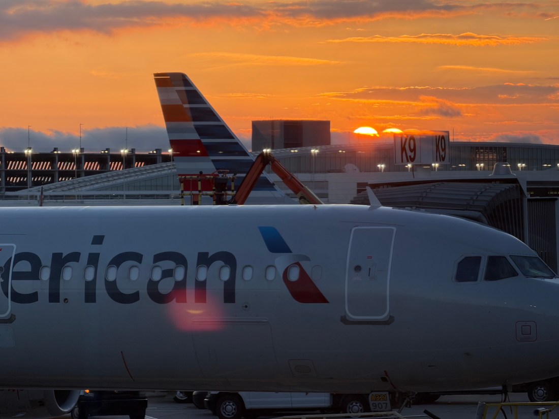
After getting up at 4:45 a.m. Eastern and catching a 7:30 flight, our little team from the GX Foundry made it all the way out to SFO, arriving a little before 10:00 a.m. Pacific to a gorgeous day in the Bay Area. (Thankfully it was a nonstop flight.)

We join the real Code for America Summit conference, or if you prefer the hashtag, on Tuesday afternoon. We wanted to arrive early so we could settle in and not run into any flight complications that could cause us to miss a full third of the conference.

Here are some photos from “Day 0” just for fun.

Looking back at SFO from the BART terminal on a sunny day with some fog on the horizon. The flight was about 5 hours in a straight shot from Columbus to San Francisco.
Since our hotel in Oakland is directly on top of a BART line, it was the fastest and cheapest way to make our way from airport to our destination. I love a good public transit system, and while the Bay Area has its challenges, it’s still one of the better-connected cities in this country, at least. In this shot you can see Eric descending the stairs and Sarah and Kristen already on the platform. It was a quick 45 minutes to reach the hotel.
Being the Memorial Day holiday, and being a downtown location, the hotel was basically empty, so an early check-in was easy. And the weather was perfection.
We walked to lunch and I noticed the bilingual street signs. Everyone knows San Francisco has a vibrant Chinatown section. I didn’t realize Oakland had followed suit.
Of course we had to get a West Coast lunch after our long trip and 3-hour time shift, so we found a local Japanese grill joint near the hotel and had fun playing chef. Kristen (out of frame to the left), Sarah, Eric and I tried ALL the meats.
Monday afternoon Sarah—a long-time Art Institute of Chicago employee and an expert in museum management—played impromptu tour guide in a visit to SFMOMA. That included a giant wall of album art in their “ART OF NOISE” exhibition, which included an original iPod and other electronics, concert posters, and more.
SFMOMA also had a fun Scandinavian piece at the top of their atrium that allowed sunlight to play through a few thousand glass panes so you could walk through it. (It should have been sponsored by Windex.)
Here’s another view of the walk-through glass installation from the lobby. The dark smudge on the bridge is a person, about 7 large art museum floors up.
And here’s a detail view from down below. And yes, you could see down through the floor when walking through.
Finally, I took a little walk after dinner and enjoyed some of the classic architecture in downtown Oakland. There’s not a ton of it—Oakland has really grown in the last 40 years, so most of the buildings are new. Still, nice to see some classics still around, and often very well-maintained.

2001: Kentucky to Alaska

I’ve driven between the midwest and Alaska a total of 6 times:

And I’ve got some photos from these epic 4,000-mile journeys. This post is the second post in the series, covering each trip.

February 2001: Louisville, Kentucky to Anchorage, Alaska

I was working at a tiny Internet banking startup in 1999, survived the Y2K transition (I was at the bank the night of December 31, 1999), and watched as the dot-com boom went bust shortly thereafter. My boss said we would be laying low for a while, waiting for the economy to rebound, but he admitted that could take years. Our jobs were safe, but they weren’t going to be dynamic or interesting for a while.

I was young, hungry to learn more, looking for adventure, and sitting in a bank for the next 5-10 years didn’t sound appealing.

The Search

So by late 2000 I started to search for new options. I interviewed at Booz Allen Hamilton in DC and was offered a job, but I turned it down. I interviewed with security vendor WatchGuard in Seattle, but that didn’t pan out. I interviewed with other tech places in Portland, Oregon, too. But during my search out west, I saw a listing for a job in Anchorage, working in a large hospital setting. Having briefly lived in Alaska, I had a sense of the adventure that represented, but I didn’t think they’d actually talk to me. In early January 2001, I threw in a resume and didn’t think much of it.

I was called back the same day.

Within a couple weeks I was on a plane to Alaska, headed to an in-person interview (there was no Zoom back then) and I took my then-girlfriend with me. We stay a couple extra days, looked around, and figured if we were okay with seeing Anchorage at its worst—the dead of winter in January—we could make the move and definitely enjoy Alaska at its best.

The Choice

They made an offer, I accepted, and preparations began. We packed, terminated the lease, prepped the car, got everything ready for a trans-continental drive with 2 people, 1 cat, and 1 dog through the depths of Canada and onto the Last Frontier in late February 2001.

We would arrive just before the start of the 2001 Iditarod.

We said we would stay 2, maybe 3 years, then head back to the lower 48. Little did we know.

Our trip was in a fully-decked-out Honda CR-V, including my first engine block heater, installed by a puzzled technician at the Honda dealer in Louisville. This trip was with my soon-to-be-wife Stephanie plus our cat Arcadio and dog Angus. The first day was… tough. The cat wouldn’t shut up. He was calmer the second day. He accepted his fate by the third.
Watson Lake, Yukon Territory is famous for the Sign Post Forest, with signs from cities and other locations around the world, brought by travelers driving the Alaska Highway. This shot was the morning after a -20° F. night at a local motel, after which the car almost didn’t start. Thankfully the block heater just barely kept the car alive.
Bison run free in parts of northern British Columbia and southern Yukon Territory. They most frequently show up on the Alaska Highway in the winter, when the deep snow can make getting around tougher for them. And yes, they can, and do, block the road at times.
Some people thought we were nuts for making the drive to Alaska in the depths of winter. In some ways, it IS a little nuts. But if you plan and prepare, it’s fine. In fact, some of the roads are far smoother in the winter because the frost heaves are gone and the snow and ice creates a smoother road surface. You should have killer snow tires at least (and maybe studded tires), and you should drive more carefully, but it’s really not that bad. This shot is from somewhere along Teslin Lake in the Yukon, before we made it to Whitehorse, YT.
It’s easy to stop just about anywhere along the Alaska Highway in winter — it’s a quiet road. There’s definitely other traffic out there, so you won’t be stranded if you break down, but it could be a while before you can get help. This shot is from just beyond Haines Junction, YT, before we barreled head-long into a white-out snow storm around Kluane Lake and Destruction Bay that would force us to stop early and stay at a motel as roughly 2 feet of snow dropped in a matter of an afternoon. Everything was cleared by morning, though.
A cross-border kiss on our arrival at the Yukon / Alaska border in late February 2001. That’s our first Cairn Terrier, Angus, who lived nearly his entire life in Alaska after being born in Ohio and living with us in Kentucky for a while. In this shot Canada is on the right, U.S. on the left. The U.S. border station is about a mile inside the actual border. But Canadian customs, heading south, is in the next village (Beaver Creek) — about 20 miles beyond the border itself.
Our cat Arcadio was a trooper on our trip (after the first day or so). Here he is in the final hotel in Anchorage, in a warm spot by the window, just happy the room is not vibrating from driving over ice and gravel for hours and hours at a time.
The ceremonial start of Iditarod 2001 was our “welcome” to Anchorage. This is a traditional sled dog transport—a wooden multi-dog kennel placed on the back of a pickup truck. The dogs often pop out their heads to see what’s up as the crowds wander around the mushers, sleds, dogs, vendors, and crowds. It’s quite the scene.

Thanks for reading! This was the second post in a five-part series covering all my north-south trips. Subscribe for future releases.