5 Photos: Death Valley 2004

If February 2004 my wife and I escaped the Alaskan winter to find a little time in the southern California sun. I’d been working for an Alaska Native Corporation on a military contract at Fort Irwin, staying in Barstow, so I’d been getting to know the Mojave a little better, but I never had enough time to explore very far.

So we made a trip of it. She flew south to meet me at the Ontario airport in SoCal and we headed out to Death Valley National Park for a few days.

Temperatures during our trip were pretty mild, with highs in the upper 60s and mid-70s depending on where you were in the Park. That’s a far cry from the 125° F high point recorded in August of that year.

Ah, the views! Most days are pretty clear in Death Valley because, well… it’s the desert. Plus, there are plenty of places to get up high and look around. The Valley is a product of massively uplifted mountain ranges on either side, so you can drive to the top of one mountain ridge and look down, then drive into the valley and back up the other ridge for more views. It’s pretty spectacular. This view is looking northwest from the eastern edge of the Park, from an area called Dantes Ridge.
The rock formations in Death Valley are really diverse, including volcanic cones, the massive mountain ranges on the east and west sides, and even a “natural bridge” area with large rock walls surrounding a canyon leading up the eastern mountainside. For an area that sees so little rain, the scale of the canyons is imposing. In this shot my wife is heading back down the canyon after our hike and scramble up the hill.
The infamous Badwater Basin is the lowest point in North America and is essentially the middle of a giant salt flat. While it doesn’t rain much in Death Valley, it does actually rain sometimes, and the water leeches minerals out of the surrounding mountains and deposits them here as the water evaporates from the heat. Even if there’s surface water around, it’s “bad” for you in every way possible.
Near Badwater Basin is the Devils Golf Course, a part of the salt flats where the minerals left behind form large, dangerously craggy crystalline rocks—the joke being if you tried to golf here, it would be hell. With an Earth Science degree, I find this stuff fascinating, so I took some time out to get a closer look. Thankfully, I didn’t leave any blood behind on the jagged rocks.
Finally, this is the famous Zabriskie Point on the eastern edge of the Park, with colored rock formations reminiscent of the Badlands in South Dakota. The “point” in the photo even suggests the crest of a rock wave passing through the hills. We visited close to sunset, which gives the whole area a muted, hazy tone.

5 photos: Earthquakes and The Lost Coast in 1992

I’m trying out something new here — limiting myself to 5 photos from my collection, and telling the story around those images.

Immediately after finishing my junior year of college I took a trip. This was late April 1992.

No parents. No friends. No cell phone. No GPS.

I flew from Ohio to San Francisco, dragging along a big duffle bag of backpacking gear—backpack, tent, stove, water bottles, sleeping bag, etc. I was headed to a weeklong Sierra Club “outings” trip in northern California, among the redwoods and out on what’s known as the Lost Coast. I’d never been there before and I didn’t know anyone on the trip.

Upon arrival in San Francisco I made my way out to the Napa Valley on a local shuttle. I was met by a German immigrant woman. She was organizing the trip. I hitched a ride with her north, up into Humboldt County where the trees are mind-bogglingly huge.

Rockin’ and Rollin’

Before I landed in San Francisco there’d been a large earthquake in northern California. It had been felt in San Francisco, but the epicenter was 200+ miles away, so the locals didn’t seen too concerned.

Except it was centered right where we were headed. I was assured this shouldn’t be a problem. So we drove north.

The “big one” on this map was a 7.2 quake hitting just 3 miles from Petrolia, a stop on our way to the Lost Coast. Special thanks to the awesome public servants at the USGS for maintaining a searchable earthquake database going back decades.

We stopped in Myers Flat for the first night, staying in a rickety old motel until everyone was able to gather the next morning and formally start the trip with breakfast at a local diner.

But here’s the thing about big earthquakes: they have aftershocks. For days.

Overnight, in the motel, there were 2 major earthquakes—the first I had ever experienced:

I was about 30 miles from the epicenter of these quakes. And I felt it. Buddy, there was no way to miss it.

The first started off as a rolling kind of shake. You could feel the waves. I was in my motel room, but bolted upright out of bed and made for the nearest reinforced doorway (which I’d seen in safety movies). When it was over, with no noticeable damage, I popped my head out the door and checked in with my motel neighbor, a long-time California resident familiar with earthquakes.

I was beaming—I’d always wanted to experience an earthquake, so this trip was off to a great start! Not having any sense of earthquake sizes, I asked my more-experienced compatriot, smiling from ear-to-ear: “Was that a big one?!?” They were… less enthused. Through an ashen face of fear they replied, “Yeah. That was a big one.” I thought it was fun, but they were worried. Way to harsh my buzz, pal.

The shaking was done, it was late, I was tired, so I went back to bed as the excitement wore off. Four hours later in the wee hours of the morning, another earthquake. This one didn’t roll. It violently shook the bed and walls. It felt angry. I was less delighted this time. I was only able to get a bit more sleep because I knew these were aftershocks rather than foreshocks. (That Earth Science training was paying off.)

Pitch your tent in a Red Cross emergency camp

The drive out to the Lost Coast takes a winding road through the northern California mountains. It’s the kind of drive you either love or hate. But it’s the only way to reach the mouth of Mattole River and the northern end of the famously undeveloped coastline.

We got stopped on the way to the coast at Petrolia because the earthquakes had brought down landslides over the road. Crews were working to clear the slides, but it would take another day or so. And we couldn’t even drive all the way into Petrolia itself—we had to walk across a bridge over the river that hadn’t been cleared by structural engineers as safe for vehicles yet. So we hiked across the bridge, a little nervously, and into town.

Petrolia was just 3 miles away from the 7.2 earthquake on April 25. The quake broke and ignited gas lines in the tiny metropolis, burning the general store / post office to the ground.

As strong and as close as the 7.2 quake was, this was, surprisingly, the worst of the damage.

Since we were on a backpacking trip, we already had all our food for the days ahead, and we had tents and sleeping bags — we were ready for anything. With the road to the coast closed, there was nothing to do but join some of the locals and relief workers in a makeshift Red Cross emergency camp in town. We pitched our fancy lightweight backpacking tents amongst the heavy emergency tents and waited. With water readily available and portable toilets, it was the fanciest backpacking destination I’d ever seen.

The next day we were given the green light to head out. The road to the coast had literally been cleared. We walked back across the questionable bridge, hopped in our cars and headed west to the Pacific, just a few miles away.

Hiking the Lost Coast

One hell of a talus pile. We don’t know if this was the result of the recent earthquakes or had been here for years.

Our group parked the cars at the end of the road and walked out onto the beach. It’s a remarkable place, so far from highways and all other kinds of infrastructure. It’s harsh and beautiful all at once.

Now THAT is how you tent camp.

After the first night on the Lost Coast one of the Californians asked if I’d felt the earthquake overnight. I had no idea there was an earthquake—didn’t feel a thing. So I replied, “I don’t wake up for anything less than a 6-point-oh.” They thought that was hilarious, coming from a Midwest boy.

Our group had all kinds of ages. We had a teenager younger than me, taking the trip with his mom. We had some folks in their 60s or perhaps older. It was quite the mix.

We hiked south along the coast. I learned just how hard it is to walk on sand with a fully-loaded backpack. I learned that a cool ocean breeze can lull you into a false sense of sunburn security. I learned a bit about the Chumash people that used to roam this landscape.

This was also the first place I’d backpacked where you needed a tide table to navigate. Some parts of the trail are impassable when the tide is in. I had topographic maps, but with the Pacific on one side and the Kings Range mountains on the other, you didn’t really need much more information. To this day, I’m not sure how far south we made it before turning around and heading back to Mattole Beach to reach our cars.

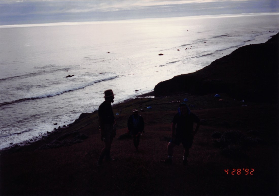
I’m on the right side of the photo, trying to not fall down the mountain, and suffering from a windswept sunburn. I literally cannot remember the names of these guys, though one of them drove me all the way back to SFO from northern California, telling me stories of working on software for VISA, the credit card company.

After the Lost Coast portion of the trip, we headed inland to hike around in the mountains and especially amongst the giant redwoods. I finally got to see what Endor is like in person. (No Ewoks.) Plus, I saw the infamous banana slugs everywhere (which, prior to this visit, sounded more like a myth to me).

To this day I marvel at the audacity of this young man—with no smartphone—jetting off by himself to California to meet up with strangers and walk around on the beach, miles and miles from a phone or a restaurant or a hospital or anything else modern. I’m not even sure I would do this today.

But if you can promise me a 6.5 quake and an ocean breeze for a few days, hit me up.

2010: Alaska to Missouri

I’ve driven between the midwest and Alaska a total of 6 times:

And I’ve got some photos from these epic 4,000-mile journeys. This post is the third post in the series.

February 2010: Anchorage, Alaska to St. Louis, Missouri

In 2010 I was invited to take a job working on digital projects for a public TV station in St. Louis that was starting up a new unit to do local journalism. That didn’t turn out well for a variety of reasons (oops!) but it gave me a reason to make the drive south once again.

In this case a college friend, Chris, flew north and joined me for the drive. Once again, we were traversing the Alaska Highway in the winter, which adds a few challenges. But really, it’s not that bad if you do a bit more planning.

On Day 1 we stopped off for photos in the beautiful valley running up from Glennallen to Tok.
Driving 4,000 miles you live and die by mileage signs. This one is looking back toward Alaska from the Yukon side of the border. Hard to believe after you cross the border headed toward Anchorage it’s another 7+ hours of driving.
Stopping off in Destruction Bay for gas and you can see what winter driving a gravel road can do, coating the back side of the car even when it’s not snowing. And yes, that was my Alaska license plate.
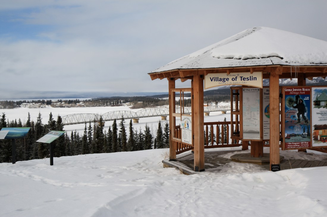
Looking back at the indigenous town of Teslin, YT from the bluffs above Nisutlin Bay. Building such a long bridge (the Nisutlin Bay Bridge) this deep into the backcountry is a remarkable feat.
Back in Watson Lake, YT for another look at the Sign Post Forest. Hundreds and hundreds of signs. It appears to grow bigger every year.
A winter Bison under a winter moon on the edge of the Yukon Territory and British Columbia.
Morning on the Alaska Highway in winter can be magical. This was shot from the car window from somewhere south of Muncho Lake, BC.
More winter wildlife on the Alaska Highway, in northern BC.
After 4,000 miles across Alaska and Canada, we finally dipped into the midwest, arriving in St. Louis, under the iconic Gateway arch.

Little did I know this would be a round-trip in 2010. In the next post I return to Alaska, this time alone, in mid-summer. See you next week!

Fire

I love a good fire.

Last year we picked up a Solo Stove and I enjoyed it through the summer. And as spring turns to summer here in Ohio, the stove is back out and warmed up. Here are a few fire photos from the collection to warm you up.

I grew up in a world of 110 film. So it is stunning to me that the smartphone cameras in our pockets today are sensitive enough to capture fire’s plasma so clearly and sharply.
One of my favorite things to do, in the right weather, is to sit out by the fire with my laptop and catch up on work or personal email or other tasks.
Ahhh… the classic campfire. It’s been a few years but I do enjoy finding fallen sticks while out on a backpacking trip and building a fire by hand.
Finally: a fire I didn’t start. This is a night shot, from quite a distance, of the Kilauea caldera back in 2011. While I didn’t get to see a full-on eruption, the caldera was at least filled and fired up in a small crater toward the center of the volcano.